Fira the Capital of Santorini & Firostefani
'the Crown of Fira'
Museums, galleries and cultural events, the island's largest shopping center and the biggest choice
of dining out and entertainment, there is so much to choose from and so many places to explore.
The whole of the Fira Caldera is connected by a path at the
cliff edge that starts just above the Mayor's office and finishes
up on the hill at the Nomikos Conference center. The volcano
can be seen from every point, as can the mesmerizing sunsets. |
 |
| METROPOLIS : THE CHURCH OF
IPAPANTI |
|
|
|
 |
| ORMOS : THE OLD PORT |
|
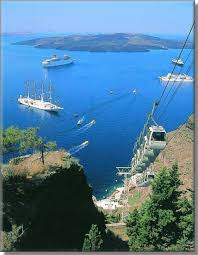 |
| FIRA CABLE CAR |
|
 |
| FIRA : CALDERA VOLCANO
VIEW |
|
| The village of Pyrgos is built amphitheatrically on a hill that offers magnificent views of Santorini
in almost all directions. On top of this hill remain the ruins of
a Venetian castle (Kasteli) that was once the island's administrative
center. Pyrgos is a typical example of medieval architecture
with narrow, labyrinthine streets, fortified walls and hidden passages. |
|
 |
| KASTELI (CASTLE) OF PYRGOS |
|
 |
| CHURCH OF KOIMISIS
THEOTOKOU : 'THEOTOKAKI |
|
Imerovigli Village & Skaros Rock :
'The Balcony of Santorini'
On the road going towards Oia, it is the next village after Fira
& Firostefani. Its position at the highest, most central part of the caldera
gave it visual command of the whole area. It also derived
importance from its proximity to Skaros Fortress. The Church
of the Panagia Malteza has a marvellous carved wooden screen
with icons depicting scenes from the Old Testament. There
is a path from Imerovigli caldera walkway to Skaros Rock and
the Chapel of Panagia Theoskepasti.
|
|
 |
| SKAROS ROCK |
|
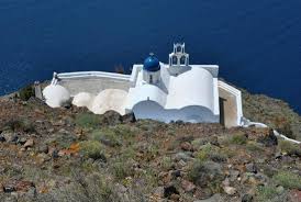 |
| CHAPEL OF AGIOS IOANNIS APOKEFALISTHEIS |
|
Oia Village : "The Place on
Top of the World"
The beauty of Oia is unsurpassed. Small white houses tier the hillside,
interspersed by splashes of rich okra, deep fuchsia, cobalt
blue, oyster pink and earthy red. Smooth winding paths interconnect,
interrupted now and then by a small church, and at every corner
there is something new to discover. Oia is best known for breathtaking sunsets;
if truth be told, sunrise in Oia is also magical.
|
 |
| KASTELI (CASTLE) OF AGIOS
NIKOLAOS - OIA |
|
|
|
 |
| OIA : THE OLD PORT |
|
|
The traditional village of Karterados
is built beside a stream in a ravine. Its existence is recorded
back to the 17th century. The original dwellings are cave
houses built deep into the rock face. During the 19th century,
it was one of the large sea captain villages on the island.
The name of the village comes from the Greek word 'karteri'
= waiting point or ambush point, probably because ambushes
were set to trap marauding pirates.
The village square has a traditional windmill.
On the left hand side as you leave the square, the road curves
sharply to the left, and there you will discover the 'Steps
of Galaios'. Barely visible from the main road is a small
neighbourhood of cobbled streets, Captains houses and cave
houses built into the rock. |
|
Perissa & Perivolos - Agios Georgios :
The Village & Beaches
Perissa is a seaside village on the
south east coast of Santorini with several kilometers of black
sand beach. Towering over the beach on the north side is the
mountain of Mesa Vouno, site of Ancient Thira. Perissa connects
with Perivolos, and the collective area is longest stretch of
beach on the island. At the base of the mountain of
Mesa Vouno, one can find the ruins of the Basilica of Agia
Irini. The building dates back to the 5th century.Two hundred meters up on the slopes
of Mesa Vouno is the tiny chapel of the Genethlion of Theotokou
otherwise known as Panagia Katefiani.Perissa stands on
the site on the ancient city of Elevsina, referred to
by Ptolelmaios, geographer, mathematician and astronomer
of the 2nd Century AC, as one of the cities of Santorini.
The port of Ancient Elevsina is thought to be near to
the Akrotiri of Exomiti. |
 |
| PERISSA BEACH |
|
 |
| THE CHAPEL OF PANAGIA KATEFIANI
OVERLOOKING PERISSA |
|
 |
| THE CHURCH OF TIMIOU STAVROU |
|
Kamari
On the south east of Santorini, the long stretch of beach lies under the impressive mountain
of Mesa Vouno. The water is deep and blue, the sand is black. A stone-paved promenade for strolling that runs parallel
to the beach stretches across the crescent moon shaped bay. In 2002 an ancient Sanctuary of the legendary Achilleas was
discovered. Amongst the stone ruins, a chalice of the Ionic
period was found, with engravings which wrote the names of
the craftsman and of the Greek hero. The excavation there, begun in 1896 by Baron Hiller von
Gaertringen in the area of Mesa Vouno, revealed ruins
of town which bore evidence of settlement as early as
9th century BC. |
 |
| KAMARI BEACH LIES UNDER THE
SHADOW OF MESA VOUNO & ANCIENT THIRA |
|
 |
| THE BEACH PROMENADE |
|
 |
| CAFES & RESTAURANTS LINE
THE BEACH |
|
In Medieval times, Akrotiri was one
of the 5 fortified settlements on the island. Akrotiri is a
village of great interest on the south west coast of Santorini. The lighthouse
is one of the best in Greece. Built at an altitude of 58 meters during
the Ottoman Rule in 1892 by the French company 'La Société
Collas et Michel', it operated initially on oil, and its beams
reached a distance of 23 nautical miles. Akrotiri is one of the most important prehistoric
settlements of the Aegean. The first habitation at the
site dates from the Late Neolithic times (from 4th millennium
BC).
|
 |
| KASTELI (CASTLE) OF AKROTIRI
: THE TOWER IS IN CENTER |
|
 |
| THE LIGHTHOUSE ON CAPE AKROTIRI |
|
 |
| VIEWS FROM AKROTIRI |
|
More villages :
 |
| Episkopi Gonia can be found at the foothills
of Profitis Ilias Mountain on the way to Kamari, 6 kilometers
from Fira in the south eastern region of Santorini.
The village also called Mesa Gonia, is in important area for producing wines. The PANAGIA EPISKOPI CHURCH was the headquarters
of both the orthodox and later the Latin bishop on the
island. Episkopi Gonia was almost completely destroyed
during the earthquake of 1956, and most of the inhabitants
moved to Kamari. |
|
 |
| Balos is a small cove north west of Akrotiri
village. In the 19th century
it was used as a small commercial harbour that serviced
the needs of the community in the area. Today, one can approach
the cave Chapel of Eisodion Theotokou, otherwise known
as Panagia of Balos via a cement paved path. In older
times, nuns used to live in caves on the Caldera cliffs,
the main cave being a shrine of Agia Triada. According
to local history, the caves have tunneled passage ways,
and were used by the nuns as refuge or to escape from
raids on the island. |
|
 |
| Exo Gonia village is on the way to Kamari,
8 kilometers from Fira in the south eastern region of
Santorini. High up on the hill one can
find the Church of Agios Charalambos, which is one of
the three largest churches in Santorini. |
|
 |
| Panagia Kalou is 8 kilometers north east
from Fira. The village belongs to the community of Imerovigli.
The village takes its name from the Church of Panagia
tou Kalou otherwise known as Koimisis of Theotokou. Panagia
tou Kalou means Holy Virgin of the Good. |
|
|
|


No comments:
Post a Comment